The Northern Pennines
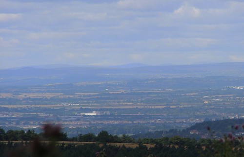
A photo taken on 2007-07-29 from the path on the west side of Highcliff, above Guisborough, Cleveland, UK. When I was younger I always assumed that the hill that stands out on the horizon (in the centre of this photo) was Cross Fell (893m), the highest point in the Pennines. But, since taking this photo, I have worked out that this peak is actually Great Dun Fell (848m) and that Cross Fell is is the long flat hill that just peeps above the horizon near the right side of the photo. The hill in between is Little Dun Fell (842m) and the long hill to the left is Mickle Fell (788m). Click on the image to go to an annotated version of the photo.
Added 2008-01-01: This is part of another photo I took at the same time as the above one. It provides confirmation that the central peak is Great Dun Fell. The white dot on the summit must be the radar station that is mentioned here.
 Tristram Brelstaff
Reader Comments (2)
http://maps.google.co.uk/maps?f=q&hl=en&geocode=&time=&date=&ttype=&q=54.68346,+-2.449083&ie=UTF8&ll=54.684066,-2.450337&spn=0.006289,0.014591&t=h&z=16&om=1